The Principality of Andorra is located in the heart of the Pyrenees, between the Kingdom of Spain and the French Republic. Its surface area is approximately 468 square kilometers, divided into 7 parishes (historically there were 6), forming the territorial basis of the administrative division in the country.
The parishes are political-administrative entities that integrate the territorial structure of the Andorran State and participate in the national political formation. Each of them has its own “Comú,” which is the organ of representation and administration at the territorial level. They are public corporations with their own legal personality, with local normative authority subject to the law, managing and protecting their interests under the principle of self-government.
Andorra la Vella
- Extension: 12 km².
- Population: 23,324 inhabitants.
- Average Altitude: 1,022 meters above sea level.
- Postal Code: AD500.
It is the smallest parish by extension but has the largest population, concentrated between Andorra la Vella and Santa Coloma. Being the capital of the country makes the parish the most dynamic and relevant commercial center in the state. It houses the headquarters of the General Council (Andorran parliament) and the majority of administrative and bureaucratic buildings of the Government. There are numerous tourist attractions, including the Casa de la Vall (former parliament), the Church of Sant Esteve, the new leisure/casino center UNNIC, and its commercial axes (Av. Meritxell).
It is also a crucial point in terms of mobility, thanks to the construction of the national bus station, facilitating connections for the population and visitors to other areas of the country through its national public transport network or transporting people externally, mainly to Barcelona, Lleida, or Toulouse.
Escaldes-Engordany
- Extension: 30 km².
- Population: 14,917 inhabitants.
- Average Altitude: 1,050 meters above sea level.
- Postal Code: AD700.
It is the second most populous parish in Andorra but the youngest of the 7. Its formation occurred due to a split from Andorra la Vella in 1978 and the union of two populations located in the central valley, Les Escaldes and Engordany, which became one due to population growth and proximity.
It has the Vivand commercial axis (Av. Carlemany), which, together with Avinguda Meritxell in Andorra la Vella, forms the main shopping tourism attraction in the country. It brings together various services, shops, and restaurants patiently awaiting the arrival of tourists.
A distinctive feature is the existence of thermal waters, which became a focal point of tourist attraction and led to the creation of one of its most emblematic and well-known buildings, the Caldea thermal center.
Sant Julià de Lòria
- Extension: 61 km².
- Population: 9,694 inhabitants.
- Average Altitude: 908 meters above sea level.
- Postal Code: AD600.
It is the southernmost parish in the country, bordering Spain. It has different quarters (territorial subdivisions) such as Juberri, Fontaneda, Auvinyà, or Nagol, as well as prominent population centers like Aixirivall or Aixovall.
Its proximity to Spain has led to the establishment of a strong commercial axis near the border, with the opening of large shopping centers such as Sant Eloi, River, or Epizen (formerly Punt de Trobada).
Among its tourist attractions, noteworthy are the town hall, its old town, the Church of Sant Julià i Sant Germà, or the Sanctuary of Mare de Déu de Canòlich.
It also has Naturland, a theme park located on the Rabassa mountain, combining attractions like the “tobotronc” and e-bike circuits with the country’s only cross-country skiing station.
Encamp
- Area: 84 km².
- Population: 12,155 inhabitants.
- Average Altitude: 1,238 meters above sea level.
- Postal Code: AD200.
It is the third largest parish in the country, behind Ordino and Canillo. Historically, its population centers were Encamp, Tremat, Mosquera, Les Bons, Vila, and El Pas de la Casa. Due to urban growth, Encamp has absorbed most of them, with only Vila and El Pas de la Casa remaining geographically differentiated from the main nucleus.
It is a mountainous hub par excellence, thanks to the multitude of routes crossing it, such as the famous trans-Pyrenean route G-11, its proximity to relevant lakes and wooded areas like Cortals, Grau Roig, and Estany de Cubil, or the numerous mountain shelters within its limits (Refugi de l’Illa, Refugi de Montmalús, Refugi d’Ensagents, etc.).
It serves as the gateway to the largest ski domain in the country (GrandValira) through the Funicamp, built in 1998, which, with its 5.6 km journey, connects Encamp to a central point in the ski resort.
La Massana
- Area: 65 km².
- Population: 11,113 inhabitants.
- Average Altitude: 1,230 meters above sea level.
- Postal Code: AD400.
It is one of the parishes where the population is more dispersed in its various municipalities. It is formed by 7 quarters: l’Aldosa, Anyós, Arinsal, Erts, Pal, Sispony, and La Massana, as well as a series of nuclei like Xixerella or Escàs.
Highlighting its access to the Parc Natural de les Valls del Coma Pedrosa, which gives its name to the country’s highest peak (2,942 meters), the Pico de l’Estany, and its numerous lakes such as els Forcats, el de les Truites, or el Negre. It is also interesting to visit the historic Hostal Palanques or the Museu Farga Rosell, one of the best-preserved ironworks in the country.
It serves as the gateway to the ski domain of Pal-Arinsal (GrandValira Resorts) through its cable car located in the town center, serving as an economic catalyst by attracting winter tourists and mountain bikers in summer.
Ordino
- Area: 90 km².
- Population: 5,225 inhabitants.
- Average Altitude: 1,298 meters above sea level.
- Postal Code: AD300.
It is one of the least populated parishes in the country, although it also has a great diversity of nuclei, with highlights like Ansalonga, Arans, El Serrat, La Cortinada, Llorts, or Sornàs.
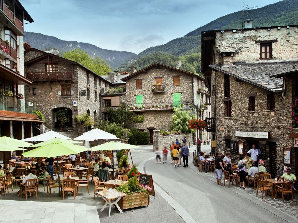
Its capital, Ordino, is known for being considered by many as the “most beautiful village in Andorra,” with its streets being an excellent example of typical mountain architecture of the Pyrenees, reflecting a rural tradition that contrasts with modern times.
The parish of Ordino is considered the historical-cultural center of Andorra, as Antoni Fiter i Rosell wrote the well-known Manual Digest there in 1748. This work is a reference discussing the functioning of Andorra in the 18th century, its history, and its “usos i costums” (customs) that served as legal references before the constitution.
It serves as the gateway to the ski domain of Ordino-Arcalís (GrandValira Resorts), frequently used for the arrivals of international cycling tours like “Le Tour” or “La Vuelta a España.”
Canillo
- Area: 121 km².
- Population: 5,160 inhabitants.
- Average Altitude: 1,526 meters above sea level.
- Postal Code: AD100.
It is the parish with the largest geographical surface area in the country and, together with Ordino, has the lowest population density. It is mainly formed by the following urban centers: l’Aldosa, Canillo, El Forn, El Tarter, Els Plans, Incles, Meritxell, Prats, and Ransol.
Its altitude (the highest in the country) provides a cold and dry winter climate, ideal for practicing winter sports, and brings it closer to the sun during the summer, promoting numerous hiking activities.
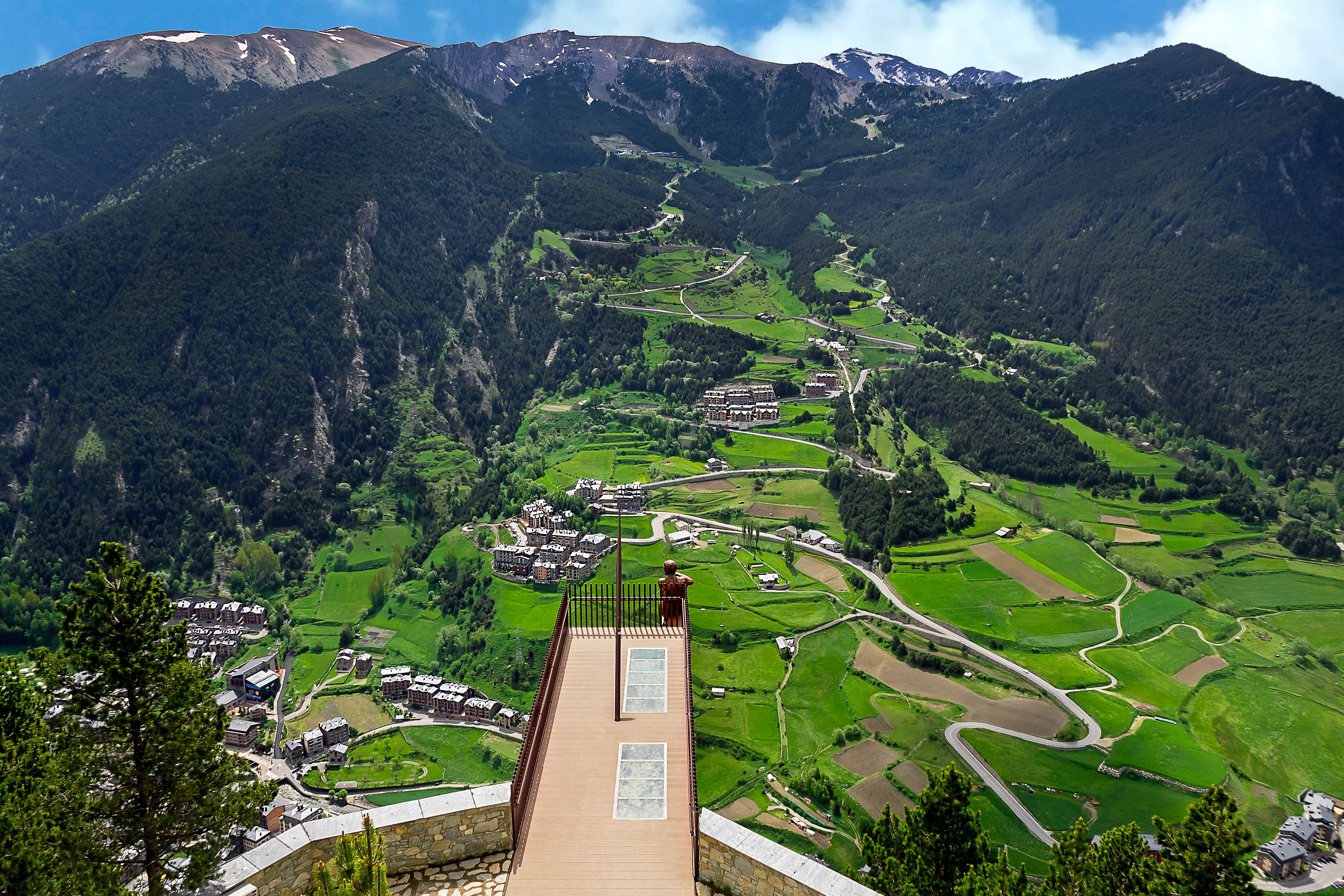
Its main tourist attractions include the sanctuary of Nostra Senyora de Meritxell, the Romanesque church of Sant Joan de Caselles, the Tibetan bridge, the Mirador del Roc del Quer, and the Palau de Gel.
It also has several entry points to the GrandValira ski domain, either from the center of the town of Canillo, from El Tarter, or from Soldeu. Its activity increases significantly during the winter months since, being close to the ski slopes, its hotels and establishments are highly frequented by tourists from around the world.